

Cave Survey with CaveMeter App
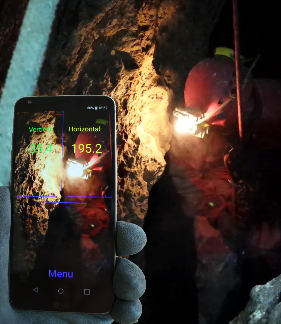 CaveMeter uses an android smartphone to survey a cave with a traverse line.
The application measures the declination and the bearing to the next measuring point and saves data in a file. Length must be determined externally with a tape or laser.
The app includes a barometric altimeter, several calibration tools and satnav option to regain cave entrances and use GPX tracks, including altitude profile.
 Download cavemeter-2026-02-22.apk
Last update 22. February 2026
An earlier version of cavemeter prior to 2025-07-17 must be deinstalled before.
Before first run please -> System settings -> Apps -> CaveMeter
add Permissions for
- Camera
- Files
- Location
There is a help function on many topics in CaveMeter.
Basic information on survey and installing the app you find here:
About the Program